
9
Learn More
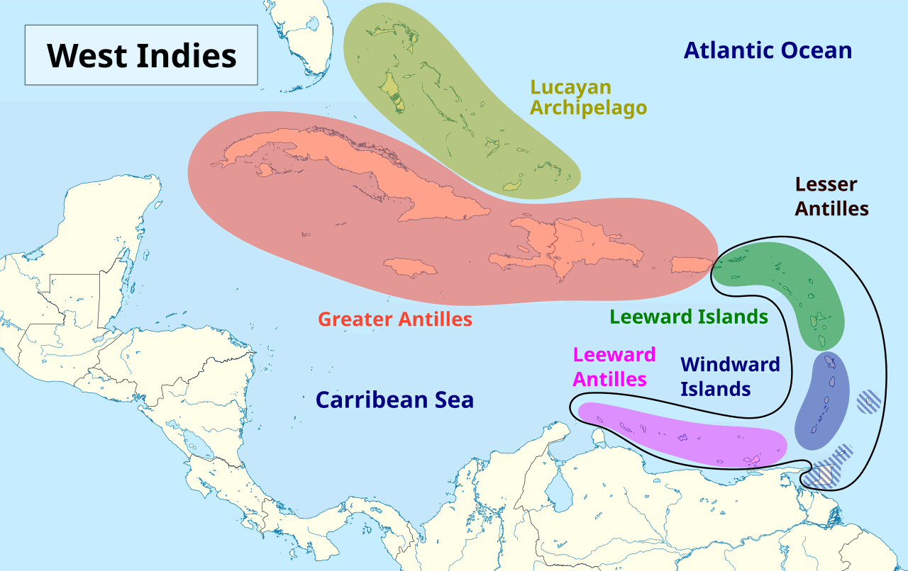
The Greater Antilles are a significant grouping of islands in the Caribbean Sea, distinguished by their size and historical importance. This island chain comprises four major landmasses: Jamaica, Puerto Rico, Hispaniola (which is home to both Haiti and the Dominican Republic), and the largest among them, Cuba. These four islands together account for nearly 90% of the total land area of the entire West Indies, as well as over 90% of its population.
Cuba, situated at the western end of the island group, is not only the largest island in the Greater Antilles but also in the entire Caribbean region. Its elongated shape and diverse geography, including mountain ranges like the Sierra Maestra, contribute to its varied landscapes. Geologically, the Greater Antilles are older and more mountainous than the smaller islands of the Lesser Antilles, often featuring high peaks and fertile valleys.
The islands of the Greater Antilles have played a central role in Caribbean history. Christopher Columbus first encountered Cuba and Hispaniola during his initial voyages to the Americas, leading to early European settlements and shaping the region's future. The strategic location and resources of these islands made them vital colonial possessions and later independent nations with rich cultural tapestries influenced by indigenous, European, and African heritage.
More Geography Trivia Questions
28
What river runs through Cairo, Egypt?
21In which city can you find the point where Germany, France, and Switzerland all meet?
21What country lies directly north of Vietnam?
21I'll give you the old name for a place, you give the new name. a. Rhodesia? b. Cathay? c. Abyssinia?
20Which town in Marin county is named after an Italian phrase meaning ''beautiful view"?
20Which of these three cities is located closest to New York? Moscow, Buenos Aires, or Honolulu?