
5
Learn More
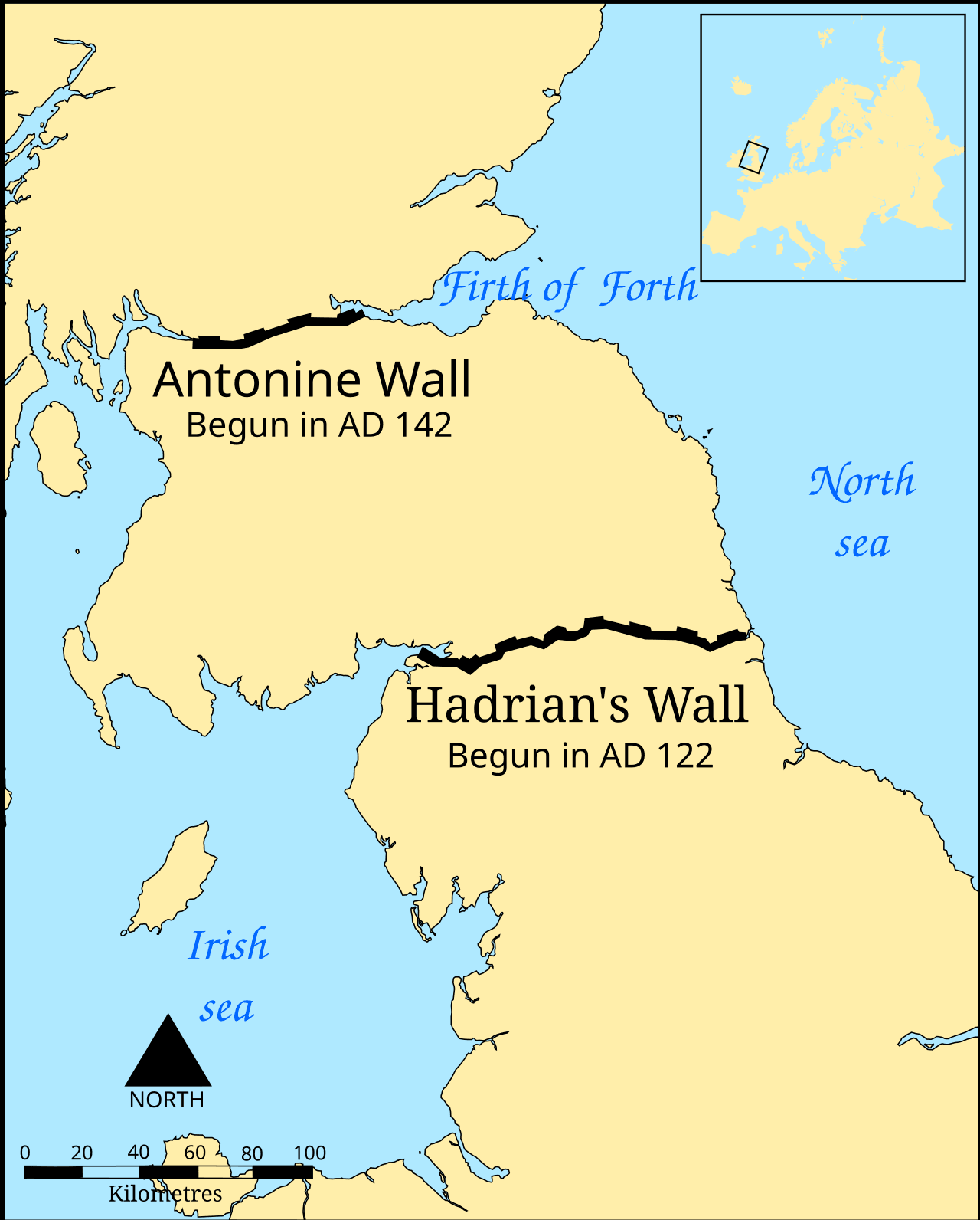
This ancient structure is a remarkable feat of Roman engineering, constructed as a defensive fortification in the reign of Emperor Hadrian. Begun in 122 A.D., it took approximately 15,000 soldiers about six years to build this massive barrier that stretches 73 miles (80 Roman miles) from coast to coast across northern England. The wall marked the northwestern frontier of the vast Roman Empire, separating the Roman province of Britannia from the unconquered territories to the north. Its purpose was not only to prevent invasions but also to control trade and movement across the border.
More than just a simple stone barrier, the fortification was a complex defensive system. It featured a series of forts, smaller milecastles, and turrets along its length. These installations housed thousands of troops who patrolled the frontier. In addition to the stone wall, a large ditch, known as the Vallum, was dug to the south, further defining the military zone.
Though much of the original structure has been dismantled over the centuries, with its stones repurposed for local buildings, significant portions remain today. It stands as a powerful symbol of Roman power and a testament to their advanced construction capabilities. Now a UNESCO World Heritage Site, this ancient monument is one of Britain's most popular tourist attractions, offering a glimpse into the history of Roman Britain.
More Geography Trivia Questions
28
What river runs through Cairo, Egypt?
21In which city can you find the point where Germany, France, and Switzerland all meet?
21What country lies directly north of Vietnam?
21I'll give you the old name for a place, you give the new name. a. Rhodesia? b. Cathay? c. Abyssinia?
20Which town in Marin county is named after an Italian phrase meaning ''beautiful view"?
20Which of these three cities is located closest to New York? Moscow, Buenos Aires, or Honolulu?